Week 4: Unary Operations
PPOL 6805 / DSAN 6750: GIS for Spatial Data Science
Fall 2025
Tuesday, September 17, 2024
Latitude and Longitude are Angles!

From Krygier and Wood (2016)
Angular Distance vs. Travel Distance
The Earth’s “width” is slightly greater than its “length” 😰

From Wikimedia Commons
Smooshing 3D into 2D
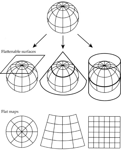
From Monmonier (2018)
How To Avoid Getting Lost in the Sauce


The US’s Ur-Choropleth #1: Population
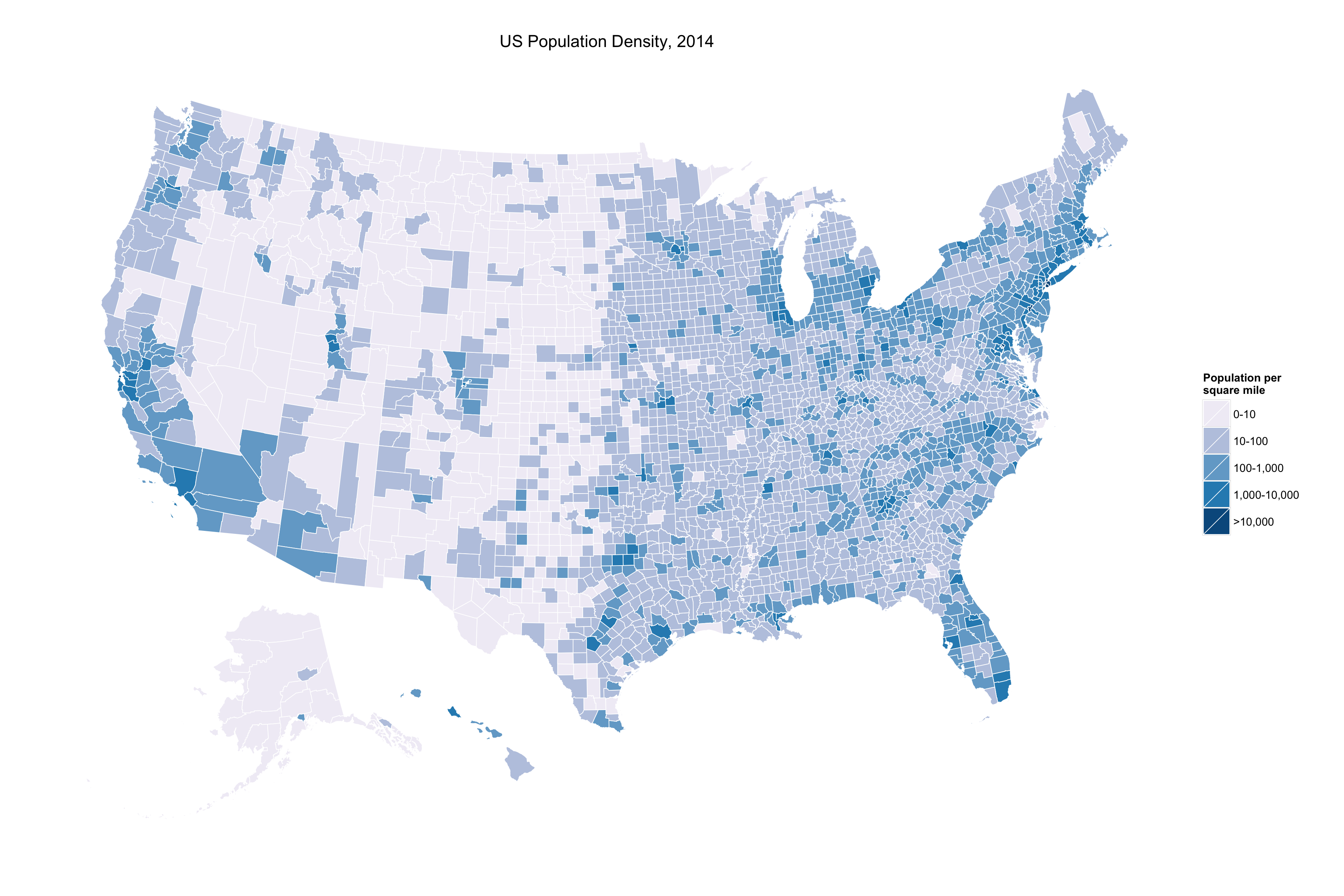
Kieran Healy, “America’s Ur-Choropleths”
The US’s Ur-Choropleth #2: Race
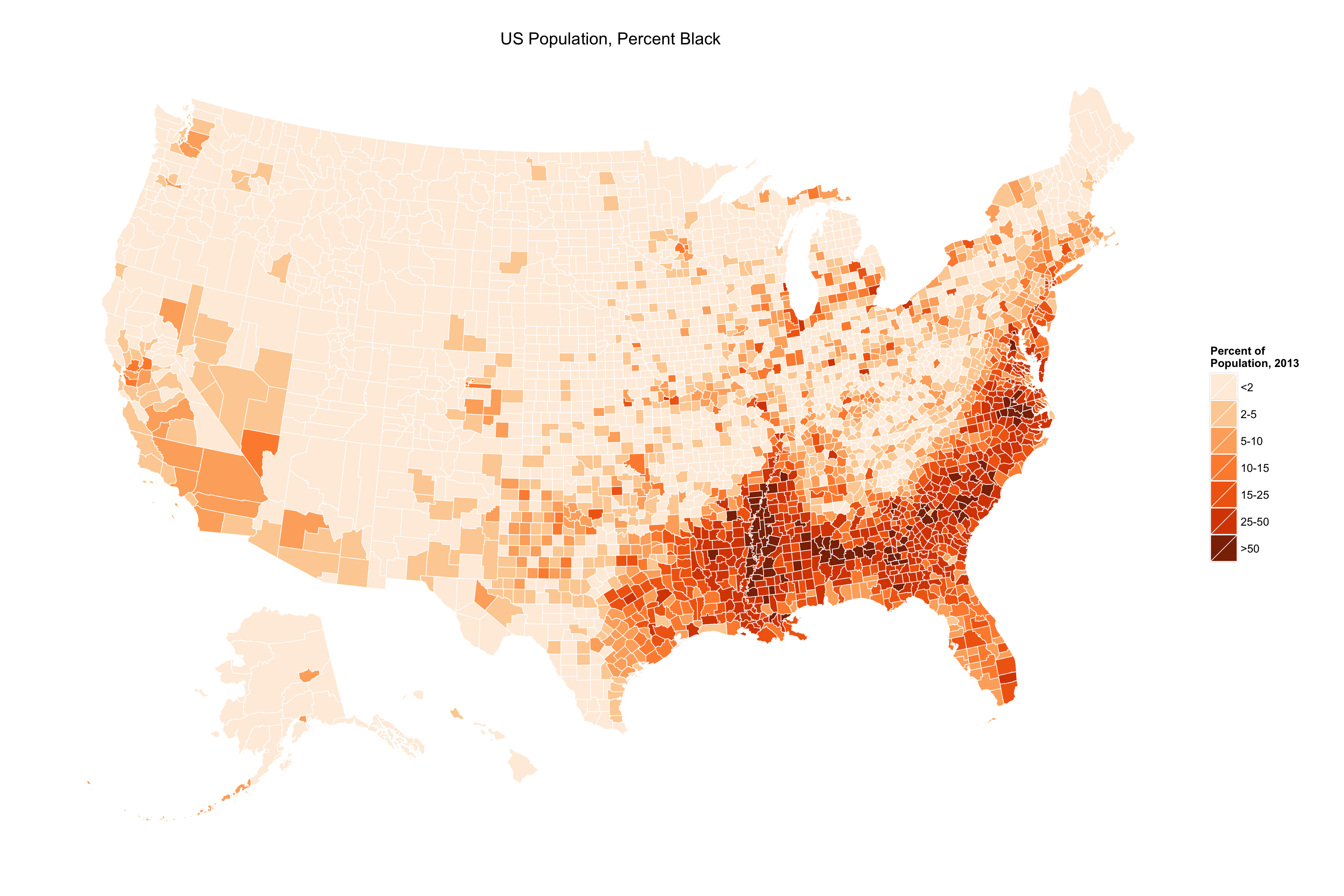
Kieran Healy, “America’s Ur-Choropleths”
Crime in Mongolia
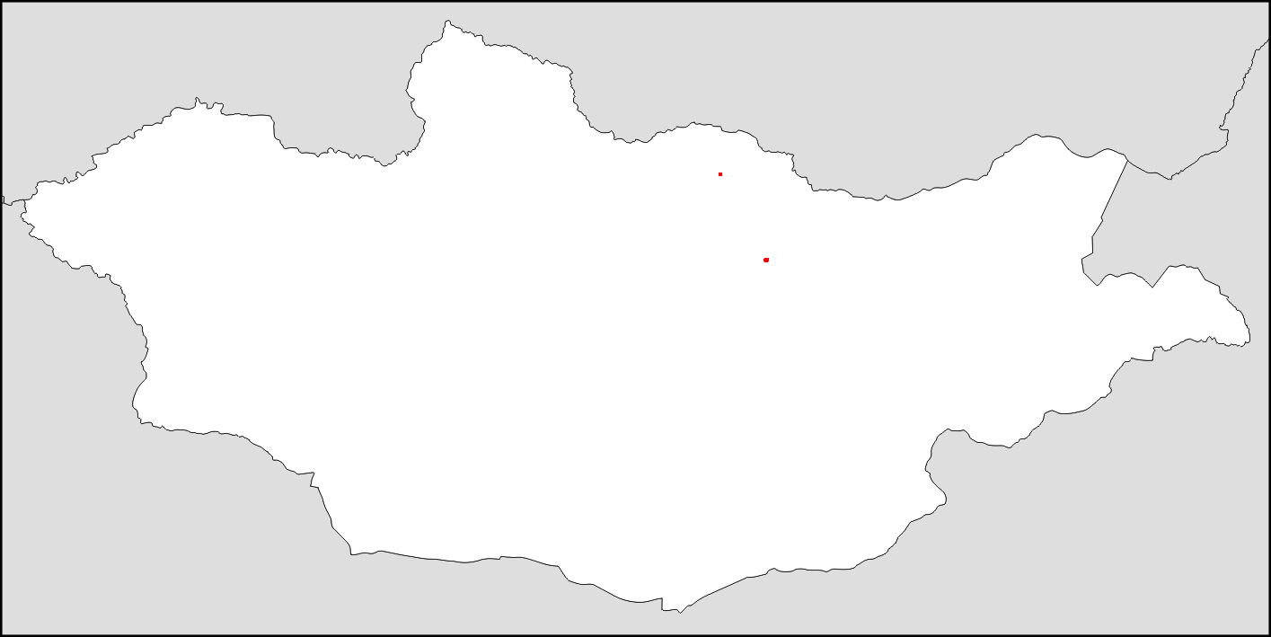
From Reddit
Population of Mongolia
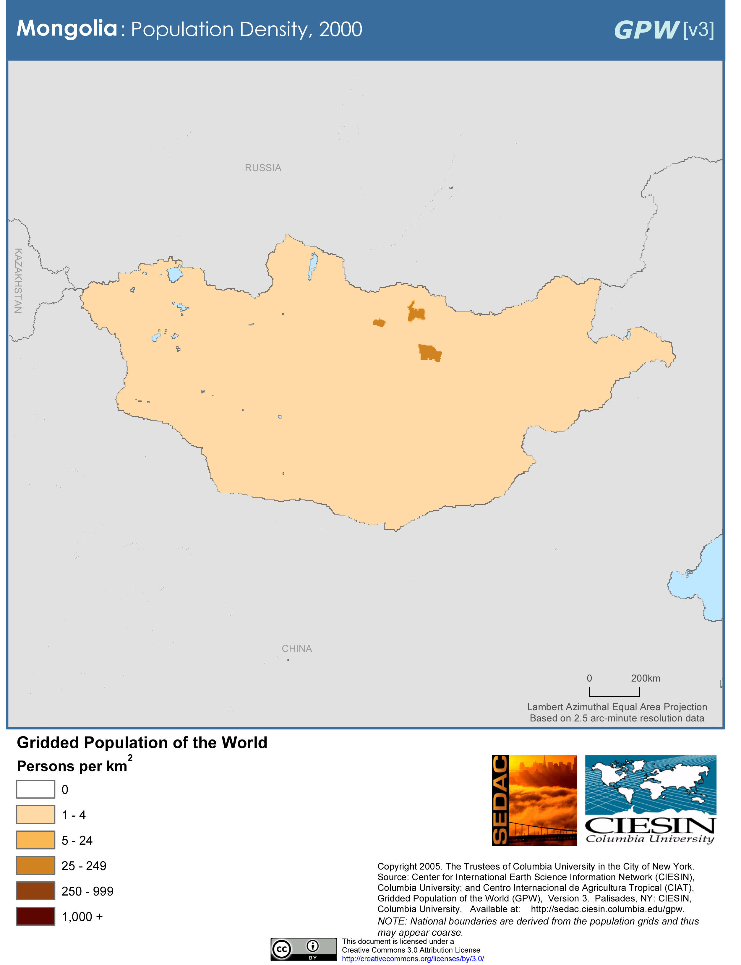
From Wikimedia Commons
Exhibit A
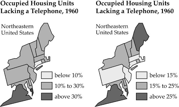
From Monmonier (2018)
Exhibit B
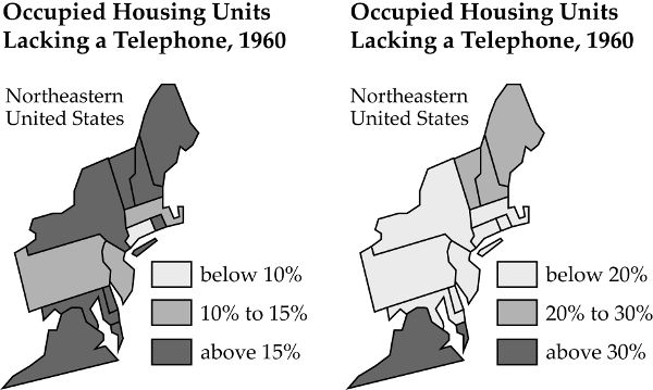
From Monmonier (2018)
Continuous Choropleth
Is poverty a “significant issue” in the US?

From Krygier and Wood (2016)
Quantile Colormap
Is poverty a “significant issue” in the US?
Assigns the same number of observations to each color

From Krygier and Wood (2016)
Equal-Area Colormap
Is poverty a “significant issue” in the US?
Boundaries between colors come at regular (equal) intervals

From Krygier and Wood (2016)
Natural-Break Colormap
Is poverty a “significant issue” in the US?
Clustering algorithm chooses classes to (a) minimize differences within classes, (b) maximize differences between classes

From Krygier and Wood (2016)
Context-Sensitive Colormap
Is poverty a “significant issue” in the US?
A government program offers special funding for counties with above 25% poverty

From Krygier and Wood (2016)
The Importance of History
Is poverty a “significant issue” in the US?

From Krygier and Wood (2016)